CIRCUIT SHORT DESCRIPTION
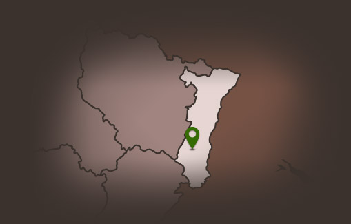
Located between wineyards and groves, Hartmannswiller were mentionned for the first time in 1187 : the Lucelle abbey owns a ferm and domain. Then the village is owned by the Murbach abbey and then by Strasbourg bishopric. In 1331, it became the property of the Waldner de Freudstein. Hartmannswiller, located next to the Vieil Armand battlefield, is almost completely destroyed during the First World War.
To reach the final cache, you will have to cross following steps …
CAR PARK
Go to the coordinates GPS : N47°51.692 E007°13.008 / Google Maps : 47 51.692, 7 13.008
RENAISSANCE HOUSE
Go to the coordinates GPS : N47° 51. 686 E007°13. 014 / Google Maps : 47 51.686, 7 13.014
The engraving on the lintel of the door represents an alsacian speciality … guess which finding the word below.
B R_ T Z E _
Count the number of holes which are in this speciality and note it here :
A =
The village was destroyed during the war 1914-1918. Le village a été détruit à 90% lors de la guerre 1914-1918. However, there are some old houses with a recognizable style. There are low, with a steep roof, visible beam, and we observe dates engraved in the lintel of the door. You are in front of a house with an engraving indicates 1737, next to the initials BB . On the lintel, there is also the speciality you had to guess, which is the bakery’s symbol.
BUILDING TRADE
Go to the coordinates GPS : N47°51.691 E007°12.968 / Google Maps : 47 51.691, 7 12.968
Which item is on the facade ?
A fire hose B = 5
A vase with flowers B = 3
A barrel B = 9
You want to see more ? Go to the shelter next to the Au Fournil’Ly bakery ! You could look up to the machine bound to the clue.
ARCHITECTURAL DETAIL
Go to the sign at the coordinates GPS : N47°51.665E007°12.872 / Google Maps : 47 51.665, 7 12.872
Which form does have the window above the door which is represented on the notice board ?
Oblong C = 2
Rond C = 8
Square C = 7
This kind of window is called oculus, or bull’s eye. This could be on a facade or a wall and aims to let the sunshine enter the different rooms.
USEFUL STONE
Go to the coordinates GPS : N47°51.725E007°12.918 / Google Maps : 47 51.725, 7 12.918
There is a stone here : find its name and count the number of letters of the name !
D =
NICE GARGOYLE
Go to the coordinates GPS : N47°51.772E007°12.933 / Google Maps : 47 51.772, 7 12.933
A gargoyle goes out the wall. How many centimeters is the stone tall ?
E =
FIRST CALVARY
Go to the coordinates GPS : N47°51.799E007°12.949 / Google Maps : 47 51.799, 7 12.949
This Cross was erected in 1656 and restored in 1807. It is decorated with the Passion instruments. Observe the different engravures, find the dices and count the sum.
F =
SECOND CALVARY
Go to the coordinates GPS : N47°51.796E007°13.061 / Google Maps : 47 51.796, 7 13.061
On the Cross, Christ suffered torments. These are engraved on the monument. There are different parts of the human body : count them.
G =
CASTLE LIFE
Go to the coordinates GPS : N47°51.760E007°13.045 / Google Maps : 47 51.760, 7 13.045
When this castle was mentioned for the first time ?
1 H 08
At the begining, this castle was owned by the Bâle bishopric. It was the see of a noble family and in 1383, the Waldner family get it. The castle was almost ruined during the Thirty Years’ War.
THE TREASURE
Find the final cache ! Here the coordinates GPS : N47°51. X E007°13.Y / Google Maps : 47 51.X, 7 13.Y
Thanks to solution of the previous clues, do some calculations :
X = [C+(A+H)xD]x(B+G)
Y = E+F
Replace letters by numbers, go to the coordinates and search the cache ! Have a good eye !
SEE MORE …
Hartmannswiller church and fortified cemetery
Church and cemetery date both from the end of the XV° century. Cemetery was built to protect people against mercenaries. It has an irregular octagon form. There were three defence towers but now it remains only two. The battlements were protected with moats full of water embezzled from the Frindolinsbach and other streams which were near the village.
Synagogue
The village hosted a jewish community from the XVII° century. It was in the castle guest-houses. In 1784, there were 78 people. Then, there were less and less (45 families in 1880, 24 people in 1936) until the Second World War. After that, there were none. So, the disused synagogue was changed in a distillation place.
Ollwiller
The Ollwiller Caste, Château d’Ollwiller, takes place in the wineyards which products the Grand Cru Ollwiller. This wine got its qualification in 1983.
Tilery
The old tilery which is next to the Ollwiller vineyard owned to Constant ZELLER. Today it is an artist house and workshop. The tilery producted a lot of tiles for the Thierenbach basilica, and also ceramic bricks. Jouxtant le domaine d’Ollwiller, l’ancienne tuilerie, aujourd’hui habitation et atelier d’artiste, appartenait à
Vieil-Armand battleship
The Hartmannswillerkopf, is a strategic point which dominates alsacian plain. Lots of battles between german and french people happenned during the First World War. Thousands german and French soldiers died on this place. A national cemetery stands here. We can realize how i twas during the war because trenchs are still here …


